
Hydrology &
Water Resources
Technical scope structured around site reconnaissance, rainfall analysis, watershed response, hydraulic modelling and flood-risk recommendations.
Hydrology & Water Resources
Technical scope structured around site reconnaissance, rainfall analysis, watershed response, hydraulic modelling and flood-risk recommendations.
Hydrology Workflow
A structured field + GIS workflow that connects survey control, catchment definition, field observations, analysis and outputs.
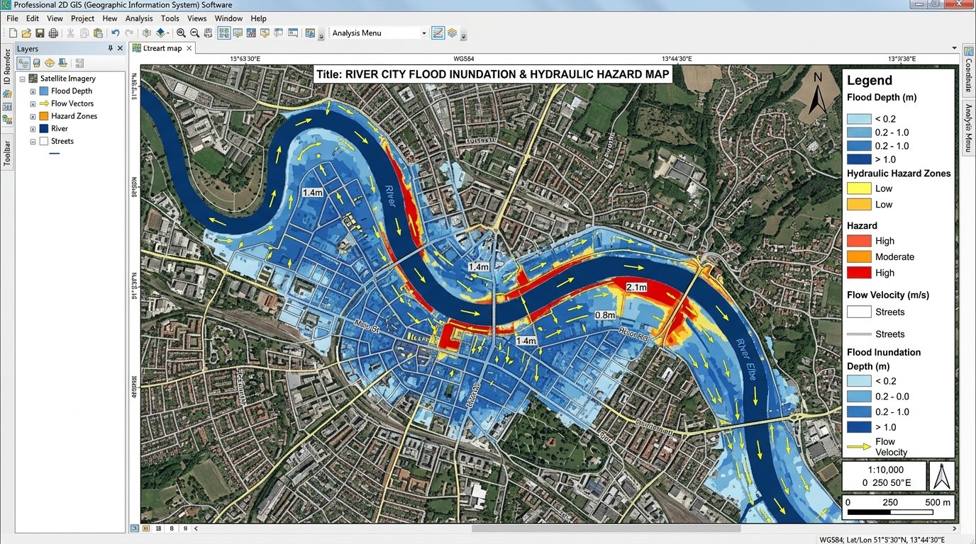
2D GIS flood inundation hazard & water depth mapping over high-resolution satellite imagery.
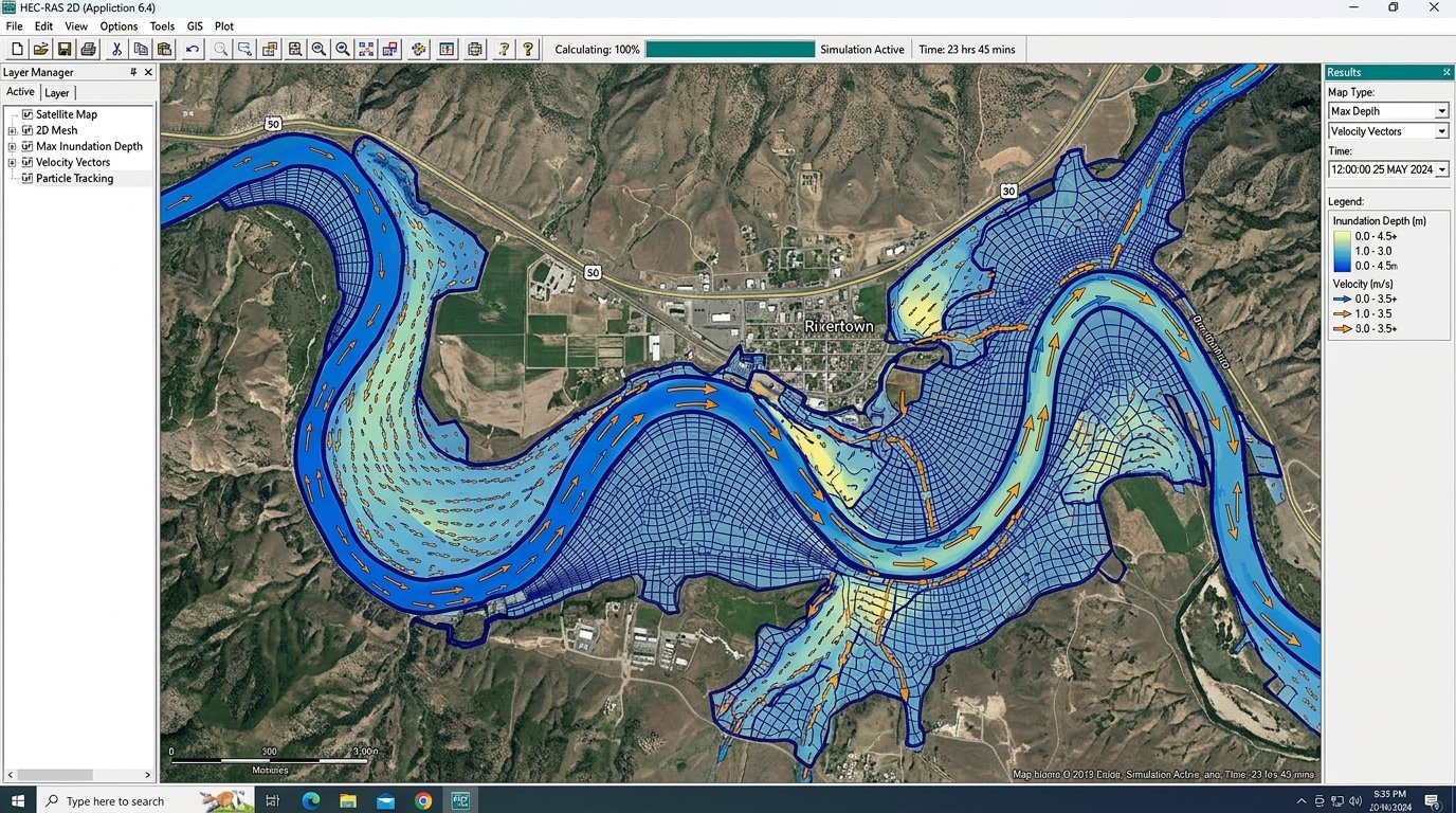
HEC-RAS 2D hydraulic simulation showing velocity vectors and high flood levels.
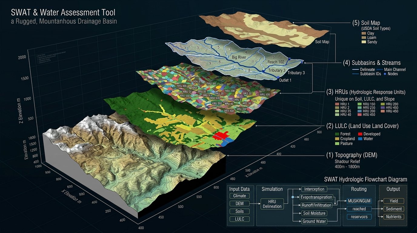
Multi-layered 3D GIS SWAT watershed model with LULC & Hydrologic Response Units.
BASE DATA
Survey control • contours • DEM • satellite / GIS layers
CATCHMENT
Watershed boundary • drainage network • sub-catchments
FIELD
Channel sections • levels • structures • outfalls • water observations
ANALYSIS
Rainfall • runoff • catchment response • drainage constraints
OUTPUT
Watershed maps • drainage maps • GIS layers • profiles • report inputs
APPLICATIONS
Hydrology & Water Resources Modules
Complete 7-stage technical workflow from initial reconnaissance to flood-risk recommendations.
01 SITE INVESTIGATION
Site reconnaissance • natural drainage, streams, ponds, water bodies, drains & culverts • waterlogging identification • GPS observations • review of topographical / DEM data
02 METEOROLOGY & RAINFALL
Minimum 50-year historical rainfall compilation • IMD/CWC review and correlation • missing-data treatment • design rainfall • IDF curves for 5, 10, 15, 20, 25, 50 & 100-year return periods
03 WATERSHED & CATCHMENT
Watershed / catchment / sub-catchment delineation • stream network • flow direction & accumulation • longest flow path • outlet identification • LULC • Hydrological Soil Group • drainage infrastructure
04 HYDROLOGICAL ANALYSIS
Time of concentration • runoff coefficient • Curve Number • Rational Method peak discharge • flow velocity and catchment runoff assessment • independent discharge verification
05 SWAT / ARCSWAT MODELLING
Watershed model • weather-data integration • Hydrologic Response Units • surface runoff • water balance • reach routing • outlet hydrographs • peak discharge • verification / uncertainty assessment
06 HEC-RAS 2D HYDRAULIC MODELLING
Terrain preparation • 2D flow area & mesh • Manning roughness and boundary conditions • hydraulic simulations • flood inundation, depth & velocity • High Flood Level • flood-prone / waterlogging areas
07 STORMWATER & FLOOD RISK
Existing drainage adequacy • stormwater and outfall recommendations • flood/waterlogging mitigation • site grading / finished levels • construction & O&M drainage • rainwater harvesting where applicable
Why Choose Our Water Engineering
Geospatial Accuracy
Integrating high-resolution LiDAR, drone topography, and GIS spatial data.
Advanced Modelling
Utilizing HEC-RAS 2D, SWAT/ArcSWAT, and GIS water modelling tools.
Expert Hydrologists
Experienced civil engineers, hydrologists, and GIS spatial analysts.
Rapid Field Delivery
Quick mobilization for stream gauge, site investigation, and DEM processing.
Hydrology & Water Resources
Technical scope structured around site reconnaissance, rainfall analysis, watershed response, hydraulic modelling and flood-risk recommendations.